Responsible for this content East Belgium Tourist Agency
Verified partner
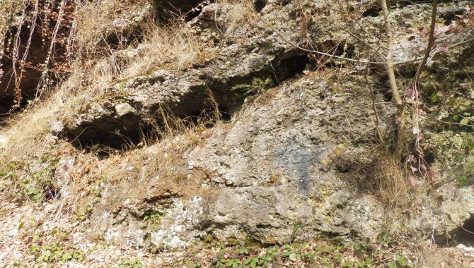
Poudingue Malmedy
Photo: Bruno Kehl, CC BY-SA, East Belgium Tourist Agency
Hint
Explanation
Selected alternatives for you
Distance 2.2 km
Duration0:50 h
Ascent94 m
Descent94 m
Highest point436 m
Lowest point341 m
As you walk along this path, you will discover a whole series of wonderful treasures hidden on Livremont hill: the Malmedy’s famous «Puddingstone» rock, shrubs and trees which are quite rare in this part of the world, the surrounding wall, the Calvary and a unique view over the city of Malmedy.