Responsible for this content East Belgium Tourist Agency
Verified partner
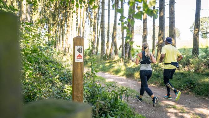
Trailrunning Bütgenbach - schwarz - rot
Photo: ostbelgien.eu/Dennis Stratmann, CC BY-SA, East Belgium Tourist Agency
Hint
Explanation
Selected alternatives for you
Thorough trail running discovery tour through idyllic landscapes around Lake Bütgenbach
moderate
Distance 23.8 km
Duration3:45 h
Ascent333 m
Descent333 m
Highest point629 m
Lowest point499 m
You start at the market square in Bütgenbach and follow the red route via the path "Zum großen Feld" towards the picturesque Warche valley. Wonderful trails with spectacular views over the hilly landscape accompany you on your way along the Warche. The trail takes you through idyllic wooded areas such as the Weywertzer and Nidrumer Heck.
Optionally, you can take a detour to the Elsenborn camp, from where you can catch a glimpse of the military training area. Then head up the former Nidrum ski slope. Once you reach the top, you have a great panoramic view of Lake Bütgenbach before walking down through a meadow to the village. Leaving Nidrum behind you, the route takes you along the Mausheck nature trail through the picturesque nature reserve of the same name.
A crisp climb up the side of the dam wall is rewarded with a sweeping view of Lake Bütgenbach. You then walk along the lake for a while before the route takes you back to the market square.
Author’s recommendation
If you still have energy left after the tour, you can use up your last reserves of energy in the outdoor gym on the Marktplatz. Alternatively, the terraces of Bütgenbach invite you to relax and enjoy a refreshing drink.
Author
Tourismusagentur Ostbelgien
Update: September 19, 2024
Difficulty
moderate
Overall difficulty
moderate
Derived from the technical difficulty and the stamina requirements.
Experience
Landscape
Highest point
629 m
Lowest point
499 m
Best time of year
Jan
Feb
Mar
Apr
May
Jun
Jul
Aug
Sep
Oct
Nov
Dec
Track types
Show elevation profile
Rest stops
Vier Jahreszeiten
Safety information
No difficulties to be expected. Enjoy the run!
Tips and suggestions
East Belgium Tourist Agency npo Hauptstraße 54 4780 Sankt Vith +32 80 22 76 64 info@ostbelgien.eu www.ostbelgien.eu BE 0715 454 578 - RJP/RPM Eupen