Description
Taking the Ravel L45a, we head towards Weywertz to the Vennbahn, which leads us to a landscape of fields and meadows further to the north. Following the curve of the path, past Nidrum and Elsenborn, we catch sight of the lake in Berg. We reach Wirtzfeld along deserted paths. There, the journey back to Bütgenbach starts.
The Italian engineer Boldo had a 23-metre-high dam built in the Warche valley between 1930 and 1932 in order to generate electricity via a turbine, which produces 2 million kWh a year. Since the lake, spanning 120 hectares (296 acres), is not used for drinking-water, all kinds of water sports are possible. In the summer you can swim, sail or enjoy a pedal boat ride here to your heart’s content. The tour starts on the Ravel L45a. You can just about make out the lake between the trees and bushes. The countryside opens up beyond the lake at the level of the railway viaduct, which towers above the Warche valley. After a few kilometres, the Vennquerbahn merges with the Vennbahn, which you follow for some five kilometres along the village limits of Weywertz.
Past cows and pastures and so few houses that they can be counted on the fingers of two hands, you reach the village of Berg after 13 kilometres. You can catch an occasional glimpse of the lake. Wirtzfeld is situated at the eastern end of the reservoir. You pass the village centre on your left. One last hill, and you cross the Holzwarche and the Warche, both of which supply the reservoir with water.
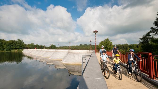
Advice: Taking node 17 towards node 93, you see the reservoir of Bütgenbach Lake after 400 m, which can be crossed via a bridge with a length of 140 m.
Follow the junction nodes: 18 > 17 > 16 > 15 > 14 > 46 > 45 > 44 > 87 > 93 > 99 > 19 > 18
Advice
Taking node 17 towards node 93, you see the reservoir of Bütgenbach Lake after 400 m, which can be crossed via a bridge with a length of 140 m.
Details
-
Difficulty Medium
-
Physical condition
-
Experience
-
Landscape
-
Highest point
630 m
-
Lowest point
524 m
-
Best period for this activity
January
-
February
-
March
-
April
-
May
-
June
-
July
-
August
-
September
-
October
-
November
-
December
Safety instructions
A route with little traffic. The only road you cross is the N647 after Elsenborn.
Recommended equipment
It is not until you get to Berg or Wirtzfeld that you will find facilities to purchase provisions or stop off at an inn or café for refreshments near the route. There is plenty of choice in Bütgenbach.
Information and additional links
East Belgium Tourist Agency npo
Hauptstraße 54
4780 Sankt Vith
+32 80 22 76 64
info@ostbelgien.eu
www.ostbelgien.eu
BE 0715 454 578 - RJP/RPM Eupen
Contact details
Departure
Bütgenbach, at the former railway station, at the end of the Seestrasse in Bütgenbach
Arrival
Bütgenbach, at the former railway station, at the end of the Seestrasse in Bütgenbach
Itinerary
Follow the junction nodes: 18 > 17 > 16 > 15 > 14 > 46 > 45 > 44 > 87 > 93 > 99 > 19 > 18
Difficulty level
-
Difficulty Medium
-
Distance
33.4 km
- Duration
2.23 h.
- Positive altitude difference
276 m
- Positive altitude difference
276 m
Circular walks
Viewpoint(s)
Catering points
Difficulty level
- CountryBelgium
- RegionRégion Wallonne
- ProvinceVerviers
- DepartmentBüllingen